Research on Autonomous Navigation of Unmanned Aerial Vehicles Based on Correlation-Based Image Comparison Methods

https://doi.org/10.31854/1813-324X-2024-10-5-108-117
EDN: DXAVDQ
Abstract
Relevance. Autonomous navigation of unmanned aerial vehicles (UAVs) is one of the key challenges in the modern aerospace industry. Specifically, for small UAVs, the task of autonomous navigation becomes even more complex due to limitations in computational resources and sensor capabilities. Optimizing navigation methods under such conditions is a pressing issue that requires solutions capable of providing high performance with minimal resource consumption.
Objective. Improving the efficiency of autonomous navigation for small UAVs by using correlation methods for image comparison. Achieving this objective is linked to the development and evaluation of algorithms that provide high-speed and accurate navigation with limited computational resources. The work uses methods such as the autocorrelation function, Pearson correlation, the structural similarity index, and a simple neural network for image comparison.
Solution. The research showed that the autocorrelation-based approach demonstrates the best performance under low computational resources. It ensures high-speed processing of the entire image and shows optimal detection accuracy. Compared to other methods presented in the study, the autocorrelation approach is capable of working not only with noise in the "reference" map but also of using alternative areas with altered patterns as detected regions.
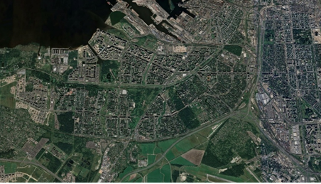
The scientific novelty of the study is determined by the systematic comparison of various methods applied to the task of image comparison for small UAVs with limited computational resources. Unlike well-known works in the field of correlation-extreme systems, this research focuses on the use of a "reference map" and a search area, representing two different images of the same terrain taken from different sources. This is a key difference, as most methods are not highly efficient in processing such images where patterns may differ significantly.
The practical significance of the developed algorithm lies in the fact that the proposed autocorrelation-based method can be used by developers of autonomous small UAV control systems to reduce computational load and increase data processing speed.
About the Authors
P. Yu. Belyaev
The Bonch-Bruevich Saint Petersburg State University of Telecommunications
Russian Federation
Russian Federation
I. A. Zikratov
The Bonch-Bruevich Saint Petersburg State University of Telecommunications
Russian Federation
Russian Federation
References
1. Bondarev A., Kirichek R. Overview of Unmanned Aerial Apparatus for General Use and Regulation of Air UAV Movement in Different Countries. Telecom IT. 2016;4(4):13‒23. EDN:YLNEPH
2. Sozzi M., Kayad A., Marinello F., Taylor J., Tisseyre B. Comparing vineyard imagery acquired from Sentinel-2 and Unmanned Aerial Vehicle (UAV) platform. Oeno One. 2020;54(2):189‒197. DOI:10.20870/oeno-one.2020.54.1.2557
3. Pastonchi L., Di Gennaro S.F., Toscano P., Matese A. Comparison between satellite and ground data with UAV-based information to analyse vineyard spatio-temporal variability. Oeno One. 2020;54(4):919‒934. DOI:10.20870/oeno-one.2020.54.4.4028
4. Lu Z., Liu F., Lin X. Vision-based localization methods under GPS-denied conditions. arXiv:2211.11988. 2022. DOI:10.48550/arXiv.2211.11988
5. Lu K., Xu R., Li J., Lv Y, Lin H., Liu Y. A Vision-Based Detection and Spatial Localization Scheme for Forest Fire Inspection from UAV. Forests. 2022;13(3):383. DOI:10.3390/f13030383
6. Nassar A., Amer K., ElHakim R., ElHelw M. A Deep CNN-Based Framework for Enhanced Aerial Imagery Registration with Applications to UAV Geolocalization. Proceedings of the IEEE Conference on Computer Vision and Pattern Recognition Workshops, CVPR, 18‒22 June 2018, Salt Lake City, USA. 2018. p.1513‒1523.
7. Zhang T., Liu C., Li J., Pang M., Wang M. A New Visual Inertial Simultaneous Localization and Mapping (SLAM) Algorithm Based on Point and Line Features. Drones. 2022;6(1):23. DOI:10.3390/drones6010023
8. Cheng C., Wang X., Li X. UAV image matching based on surf feature and harris corner algorithm. Proceedings of the 4th International Conference on Smart and Sustainable City, ICSSC, 5‒6 June 2017, Shanghai, China. IET; 2017. DOI:10.1049/cp.2017.011
9. Zhao J., Zhang X., Gao C., Qiu X., Tian Y., Zhu Y., Cao W. Rapid Mosaicking of Unmanned Aerial Vehicle (UAV) Images for Crop Growth Monitoring Using the SIFT Algorithm. Remote Sensing. 2019;11(10):1226. DOI:10.3390/rs11101226
10. Jiang S., Jiang W., Guo B., Li L., Wang L. Learned Local Features for Structure from Motion of UAV Images: A Comparative Evaluation. IEEE Journal of Selected Topics in Applied Earth Observations and Remote Sensing. 2021;14:10583‒10597. DOI:10.1109/JSTARS.2021.3119990
11. Fan J., Yang X., Lu R., Li W., Huang Y. Long-term visual tracking algorithm for UAVs based on kernel correlation filtering and SURF features. The Visual Computer. 2023;39:319‒333. DOI:10.1007/s00371-021-02331-y
12. Tsai C. H., Lin Y. C. An accelerated image matching technique for UAV orthoimage registration. ISPRS Journal of Photogrammetry and Remote Sensing. 2017;128:130‒145. DOI:10.1016/j.isprsjprs.2017.03.017
13. Lee K.W., Park J.K. Comparison of UAV Image and UAV LiDAR for Construction of 3D Geospatial Information. Sensors & Materials. 2019;31(10):3327–3334. DOI:10.18494/SAM.2019.2466
14. Lin Y. C., Cheng Y.T., Zhou T., Ravi R., Hasheminasab S.M., Flatt J.E., et al. Evaluation of UAV LiDAR for Mapping Coastal Environments. Remote Sensing. 2019;11(24):2893. DOI:10.3390/rs11242893
15. Bandini F., Sunding T.P., Linde J., Smith O., Jensen I.K., Köppl C.J., Butts M., Bauer-Gottwein P. Unmanned Aerial System (UAS) observations of water surface elevation in a small stream: Comparison of radar altimetry, LIDAR and photogrammetry techniques. Remote Sensing of Environment. 2020;237:111487. DOI:10.1016/j.rse.2019.111487
16. Ezuma M., Anjinappa C.K., Semkin V., Guvenc I. Comparative Analysis of Radar Cross Section Based UAV Classification Techniques. arXiv:2112.09774. 2021. DOI:10.48550/arXiv.2112.09774
17. Palubinskas G. Image similarity/distance measures: what is really behind MSE and SSIM? International Journal of Image and Data Fusion. 2017;8(1):32‒53. DOI:10.1080/19479832.2016.1273259
18. Ullah A., Elahi H., Sun Z., Khatoon A., Ahmad I. Comparative Analysis of AlexNet, ResNet18 and SqueezeNet with Diverse Modification and Arduous Implementation. Arabian Journal for Science and Engineering. 2022;47:2397‒2417. DOI:10.1007/s13369-021-06182-6
Review
For citations:
Belyaev P.Yu., Zikratov I.A. Research on Autonomous Navigation of Unmanned Aerial Vehicles Based on Correlation-Based Image Comparison Methods. Proceedings of Telecommunication Universities. 2024;10(5):109-118. (In Russ.) https://doi.org/10.31854/1813-324X-2024-10-5-108-117. EDN: DXAVDQ
Views:
574
JATS XML